Kibawe (Kibawe)
 |
In the early days of the American regime, Kibawe was populated by a tribe of Mamadas people. The Mamadas people were nomadic by nature and subsisted on hunting and forest products. They maintained small plots of corn, camote and gabi in places where they built their temporary shelters. They practised a feudal type of government and were responsible only to their datus who governed as their political chieftain, judge, religious leader and armed-forces chief. The most famous among the “datus” was Datu Mambantayao. Datu Mambantayao's bravery and love for his subjects were unexcelled and remain in the hearts and minds of the people to this day. One of the historic events of his life as a datu was the capturing of a lady whom he loved. She was abducted by a tribe from Bugcaon, Malaybalay, Bukidnon, seventy kilometers away from Kibawe. Datu Mambantayao, along with his armed trained warriors marched to Bugcaon, which they attacked heavily, plundering and killing the Bugcaons’ chieftain for the recovery of the lady who he later married. Datu Mambantayao named this place Kibawe from the word “Guibawe” meaning recovery.
Bukidnon was eventually created as a separate province from Agusan. Kibawe became a barrio of Maramag. It now occupied the southern portion of Bukidnon, bounded on the north by Maramag, on the south by Carmen, Cotabato, on the east by Magpet, Cotabato and on the west by Lanao Sur. It covered the present areas of the mother municipality of Kibawe, the daughter municipalities of Dangcagan, Damulog and Kadingilan and grand daughter municipality of Kitaotao, with a land area of approximately 1,250 km2
Kibawe became a municipal district in 1931 and then became a regular municipality on July 1, 1956 under Executive Order 272 issued by then vice president, later president of the Philippines, Carlos P. Garcia. Later on, barrio Dangcagan separated into a regular municipality. The growth and development of the municipality served high after the Second World War as immigrants from all over the country (mainly from Visayas and Mindanao) came flocking into the fertile valleys and low mountains of the community.
The original populace of the town, the Manobos, have practically been replaced by the above-mentioned lowlanders. To date, only a few Manobos remain in the interior barrios. In the year 1972, the big barrios of Damulog and Kadingilan were created into separate municipalities. Thus, Kibawe retained the land area of 301.43 km2. The Kibaweños of today are people of diverse ethnic origin including the autochthonous Manobos and Bukidnon Lumad tribes, as well as the immigrant Cebuanos, Boholanos, Ilonggos, Negrenses and Warays. All are hardworking, friendly, peace-loving and law-abiding. Together, they work towards a common goal - the socio-economic advancement and amelioration of their lives as a whole.
Map - Kibawe (Kibawe)
Map
Country - Philippines
 |
 |
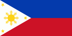
| Flag of the Philippines | |
Negritos, some of the archipelago's earliest inhabitants, were followed by successive waves of Austronesian peoples. Adoption of animism, Hinduism and Islam established island-kingdoms called Kedatuan, Rajahnates, and Sultanates. The arrival of Ferdinand Magellan, a Portuguese explorer leading a fleet for Spain, marked the beginning of Spanish colonization. In 1543, Spanish explorer Ruy López de Villalobos named the archipelago Las Islas Filipinas in honor of Philip II of Spain. Spanish settlement through Mexico, beginning in 1565, led to the Philippines becoming ruled by the Spanish Empire for more than 300 years. During this time, Catholicism became the dominant religion, and Manila became the western hub of trans-Pacific trade. In 1896, the Philippine Revolution began, which then became entwined with the 1898 Spanish–American War. Spain ceded the territory to the United States, while Filipino revolutionaries declared the First Philippine Republic. The ensuing Philippine–American War ended with the United States establishing control over the territory, which they maintained until the Japanese invasion of the islands during World War II. Following liberation, the Philippines became independent in 1946. Since then, the unitary sovereign state has often had a tumultuous experience with democracy, which included the overthrow of a decades-long dictatorship by a nonviolent revolution.
Currency / Language
| ISO | Currency | Symbol | Significant figures |
|---|---|---|---|
| PHP | Philippine peso | ₱ | 2 |
| ISO | Language |
|---|---|
| EN | English language |
| TL | Tagalog language |


